


Surveying has undergone significant transformations throughout history, evolving from rudimentary methods to advanced technologies. This journey reflects humanity’s relentless pursuit of precision in understanding and delineating the land.
Ancient Beginnings: The Foundation of Surveying (circa 3000 BC – 1600 AD)
Surveying traces its roots to ancient civilizations:
- Egyptians (circa 3000 BC): Developed early surveying techniques to re-establish farm boundaries after Nile River floods and for monumental constructions like the Great Pyramid of Giza.
- Romans (circa 300 AD): Recognized land surveying as a profession, establishing basic measurements and creating detailed land records.
These early methods laid the groundwork for future advancements, emphasizing the importance of accurate land measurement.
The Age of Instruments: Enhancing Precision (1600 – 1800)
The development of specialized instruments marked this era:
- Gunter’s Chain (1620): Introduced by Edmund Gunter, this measuring device allowed for more accurate land measurements.

- Theodolites (late 16th century): Instruments like those described by Leonard Digges enabled precise angle measurements in horizontal and vertical planes.
These tools improved accuracy but still required manual calculations and significant effort.
The Industrial Revolution: Standardization and Expansion (1800 – 1900)
As nations expanded, the need for standardized surveying grew:
- Great Trigonometric Survey of India (1801): An extensive project that mapped the Indian subcontinent with high precision.
- Public Land Survey System (1785): Established in the United States to systematically divide and sell western territories.
These initiatives underscored the importance of uniform methods in land division and record-keeping.
The Digital Revolution: Entering the Computer Age (1950s – 2000s)
The latter half of the 20th century introduced electronic advancements:
- Electronic Distance Measurement (EDM) (1950s): Devices like the Tellurometer used microwaves to measure long distances accurately.
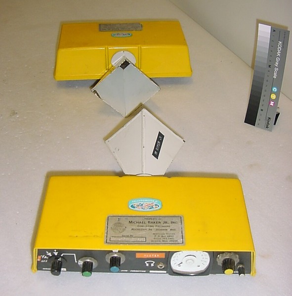
- Global Positioning System (GPS) (1978): The launch of GPS satellites revolutionized positioning, allowing for real-time, high-accuracy measurements.
These technologies reduced manual labor and increased measurement precision.
The AI Era: Transforming Surveying with BoundaryLogic Trace (2020s – Present)
Today, artificial intelligence is reshaping surveying practices:
- Trace: An advanced tool that automates the conversion of textual metes and bounds legal descriptions into precise, digital boundary plots.
By leveraging AI, surveyors can achieve unparalleled efficiency and accuracy in boundary plotting.
Conclusion
From ancient rope stretchers to AI-powered platforms, surveying has continually evolved to meet the demands of accuracy and efficiency. Embracing tools like BoundaryLogic Trace represents the latest step in this ongoing journey, honoring a rich history while looking toward a promising future.