

Availability: All plans.
You are holding a legal description and you are about to upload it. Two minutes of reading it first tells you three things: whether Trace can build geometry from it at all, whether it will land in the right place on the map, and whether it belongs in the free manual plotter instead.
This guide teaches that read. AI Automated Plotting is the only feature in BoundaryLogic Trace that consumes a credit. Manual plotting and exports never do. So the reading costs nothing, and it is the cheapest step in the job.
The example lines quoted here are invented for this guide. No county, road, subdivision, watercourse or neighbouring owner named in them exists, and no line comes from a real recorded document.
What you will need
- The description in front of you, on paper or on screen. Nothing else. You do not need a project, a plan or a role to do this.
Trace takes descriptions two ways
The two paths take different input, and knowing which one you are aiming at is most of the pre-screen.
- The manual plotting editor takes calls, written in a shorthand of its own. It is not a prose reader. A line that reads like a sentence out of a deed is rejected. It is free on every plan.
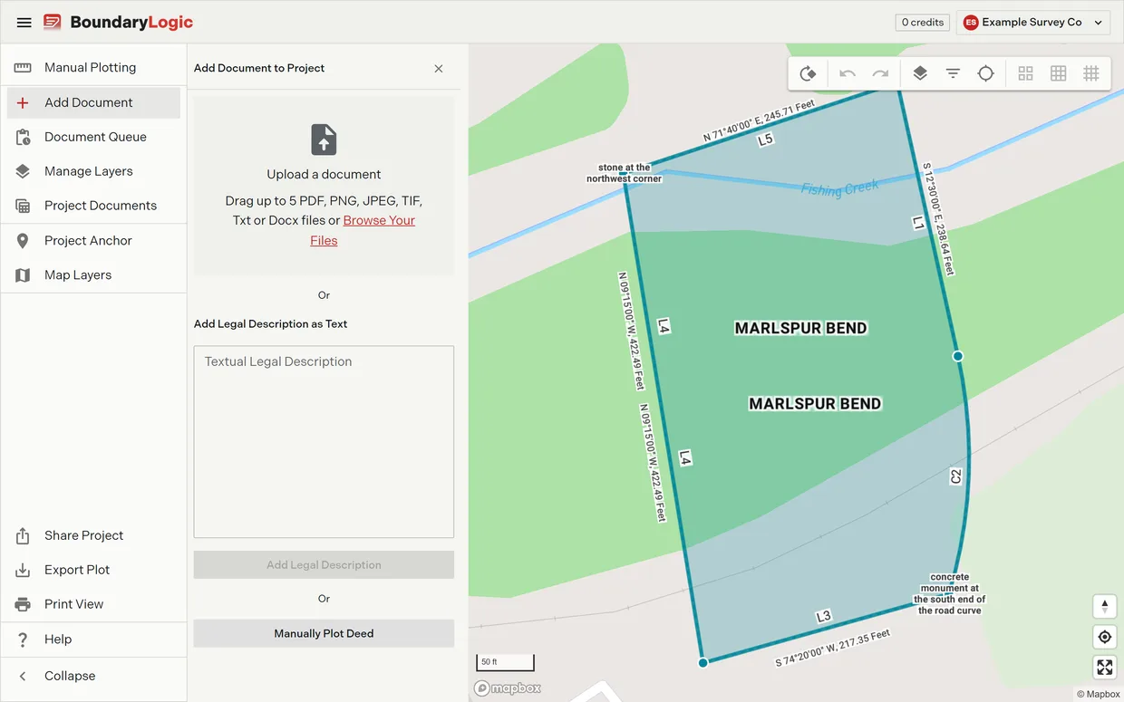
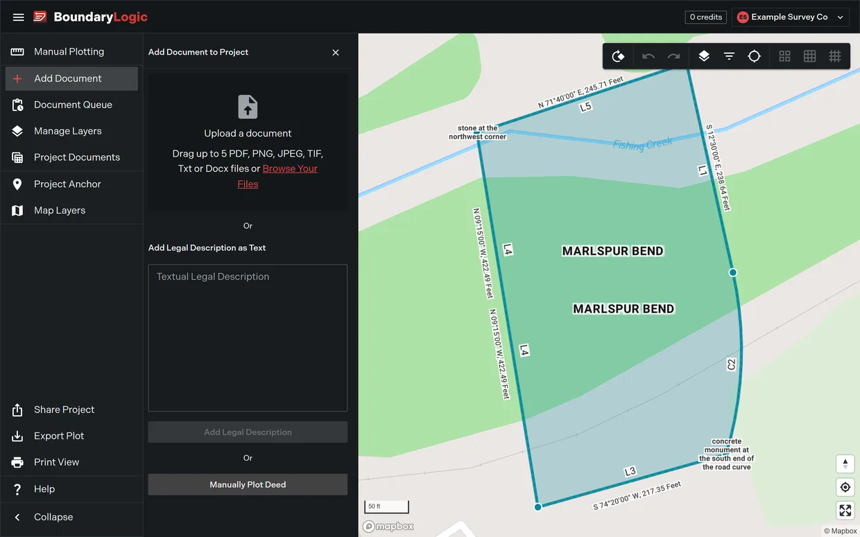
- AI Automated Plotting takes prose. Upload the document, or paste the description into Add Legal Description as Text, and Trace reads it into calls. This is the path that spends a credit.
What counts as a course
Both paths are looking for the same thing: a course that carries a direction and a distance, or a curve call fixed by enough parameters to draw one arc.
| What the description gives | Forms Trace takes |
|---|---|
| Directions | Quadrant bearings, degrees only, minutes only, cardinal shorthand, bare azimuths clockwise from north, deflection angles, interior angles |
| Distances | Feet, meters, chains, rods, poles, perches and links, Texas varas, compound forms, passing calls |
| Curves | A radius and one more parameter: arc length, central angle, chord length, degree of curve, chord bearing, entry tangent or radial direction. A tangent curve inherits the bearing of the call above it |
| Monuments | At either end of a call, as trailing text, on their own line, or several on one point. They label the drawing and never move the geometry |
| Aliquot parts | Section shorthand, quarters, halves, dimensioned strips and whole sections, nested outward from the smallest part |
| Easement centerlines | Symmetric, asymmetric and one sided, with widths given against a range of courses |
A description whose every course gives one of those directions and one of those distances plots. The worked example in How to plot a metes and bounds description is exactly that shape: five calls, four lines and a curve to the right along a road margin, closing on 2.4341 acres. Nothing in it needs a workaround.
Two ways a description fails, and only one is a failure
Plotting and locating fail differently. Telling them apart is the single most useful thing on this page, because half of what gets reported as a bad plot is not a plotting problem at all.
It will not plot. The language carries no bearing, no distance, no curve and no aliquot part, so there is nothing to build geometry from. “Thence with the meanders of the Tamsel River” describes a boundary perfectly to a human being and gives Trace nothing to draw. Retrying does not change that, and neither does a clearer scan.
It plots but it will not locate. The geometry builds correctly. The description ties to the world only through a recorded instrument, a street, an adjoiner, or a physical feature, none of which Trace can resolve to a position on the earth. The tract draws right and sits nowhere in particular until you place it.
The second one is not a failure. It is the normal outcome for a description that begins at an iron pin, and you finish it yourself in four ways: Move Your Plot Location by street address, by typed latitude and longitude, by a PLSS corner, or straight onto the project’s own anchor. The Project Anchor pane sets the same sources for a whole project at once.
The PLSS route needs Professional or above. On Free the PLSS tab and the PLSS placement panel open the plan chooser instead of switching on. The other three placement routes work on every plan.
A call Trace cannot read is dropped, and the numbers do not say so
This is the behavior that makes the whole pre-screen worth doing.
Where a call cannot be read, Trace marks the line and then leaves it out of the traverse. Area, perimeter and closure are reported for the calls that survived. Those figures are arithmetically right for those calls. They say nothing at all about the one that went missing.
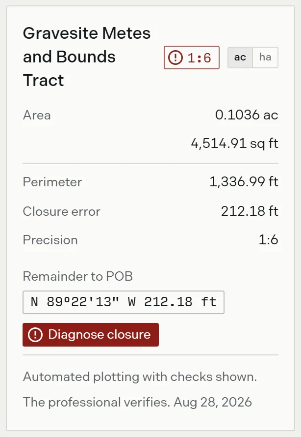
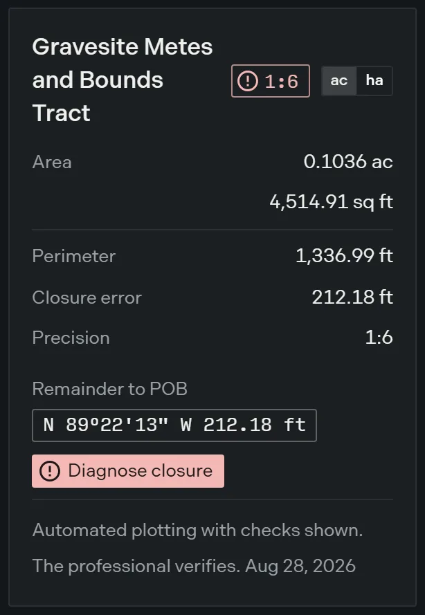
Sometimes the loss is obvious. Drop the third call of a four sided tract and the result reports a misclosure of 300.00 feet at a precision of 1:2, in red, and offers Diagnose closure. Nobody files that plot by accident. Any open traverse presents the same way on the tract card, whatever opened it:
Sometimes it is not obvious. Where the missing call sits between two courses that happen to run out and back, the same failure reports a perimeter of 800.00 feet, an area of 0.0000 acres, and a closure of Closed, in green. A description missing an entire boundary line can present a green closure reading.
So read this the right way round. Closure is a closure check, not a completeness check. It answers whether the calls Trace read come back to where they started. It never answers whether Trace read all of them, and nothing in Trace compares the number of calls plotted against the description in your hand. That comparison is yours.
The real signal sits on the line itself. An unreadable line is underlined, marked with an error, and carries its message when you hover it, and the status bar repeats it with the line number while your cursor sits on that line. Read the markers. Do not read the closure figures for this.
Language that reads as risky and plots anyway
Start here, because avoiding these means avoiding work Trace already does.
| What you see | What happens |
|---|---|
| Directions as a single angle clockwise from north, such as an azimuth of 135 30 20, with no quadrant letters | Plots. Bare azimuths are first class input, and four of them in the four quadrants plot with no errors and no markers at all |
| A course turned off the previous course: an interior angle of 90 00 00 left, or a deflection of 30 degrees right | Plots in the manual editor, cleanly. On the upload path the same language raises the Internal Angles warning, which is a real disagreement between the two paths and worth knowing about |
| Monuments named at the corners, or a curve running along a road margin, with a bearing and a distance still given for every course | Plots. A monument labels the drawing and moves nothing, and a tangent curve takes its bearing from the call above it. The presence of a road or a monument is never the problem |
The interior angle case is the one to act on. Trace warns on the upload path about language the free editor draws without complaint, and the warning does not stop the credit being spent. Type those angle calls into the editor instead.
Language that will not plot
Every row here has the same shape: the boundary lives in a source Trace has no access to, or in no source at all.
| What you see | What Trace does | What to do |
|---|---|---|
| A run “along the meanders of” a river, creek, shoreline or ridge, with no bearing and no distance for that run | Drops that call and reports figures without it. On the upload path it raises the Referential Legal Description warning | Where you hold a survey that measured the meander, type its courses as a short series of calls. Say on the face of it that a series of chords is not the feature the record calls for |
| A course reading “thence with the east line of the Quillane tract to an iron pin” and nothing more | Drops that call. This is the family that produces a green closure reading with an area of 0.0000 acres | Read the bearing and distance off the adjoiner’s own description and type them as a call. Trace holds no recorded documents and cannot do this step |
| A course running “along the westerly right of way line of Foundry Line Road”, with no bearing and no distance | Drops that call. Trace cannot resolve a street name to a line | Take the margin’s own courses from the recorded plat or the highway plan if you hold one. Note that a road call with a stated bearing and distance plots normally, and most of them state one |
| A line described only as a line in another instrument: “the east line of the tract described in Deed Book 402, at page 17” | Drops that call, and raises Referential Legal Description on the upload path | Resolve the line from the referenced instrument and type the resolved course. Where the chain of references never terminates in stated courses, it cannot be resolved from paper |
| A metes and bounds course ending at a PLSS corner instead of at a distance: “thence run North to the Northeast corner of the Northwest Quarter of the Northeast Quarter of said Section 22” | Drops that call, and raises Plss Boundary References on the upload path. Trace does not mix the two plot types in one description | Compute the distance and the course becomes an ordinary call that plots. Written as a bearing and a distance, the same course plots with no errors |
| A whole description that is a lot and block and a subdivision name with a plat book and page, and no courses anywhere | Nothing to plot. On the upload path it raises the Lot and Block warning, which states that Trace has no access to the related plat | Plats and lot and block are outside what Trace plots. Read the manual editor warning in this guide before you type one anywhere |
| Positions given as stations and offsets: “beginning at Station 12+50.00, 40.00 feet left of centerline” | Rejects every line and draws no tract at all, which is the honest outcome. Stations are not input anywhere in Trace | Where the centerline is separately described by bearing and distance, type it as calls and declare the corridor as a centerline easement with widths given by call range |
| A curve described with a spiral length and two radii, or named a spiral, transition or easement curve | Drops the line. Trace has no spiral form at all, so it is not a malformed curve, it is not a curve. On the upload path it raises Complex Curves | Nothing. Spiral curves are not handled |
| A quantity and a general position and nothing else: “five acres, more or less, in the northwest corner of” a larger tract | Rejects the line and draws no tract | Nothing. An area and a corner do not determine a boundary, so there is nothing to construct |
Never type a lot and block reference into the manual editor
This one earns its own heading because it is the only case where Trace returns a confident wrong answer instead of refusing.
The upload path handles it correctly: it tells you it has no access to the plat. The manual editor has no such warning, and a lot and block line written with commas is read as an aliquot section reference instead. Typed in full, Lot 14, Block 3, Quarrystone Reach subdivision, as recorded in Plat Book 9, page 44 produces a four call tract of 640.0000 acres, reported Closed, with no error and no warning. The same line without its commas is correctly rejected.
Until the editor gains a warning of its own, this pre-screen is the only thing standing between a lot and block reference and a nominal section of 640 acres on your drawing.
Two honest partial routes exist and neither is a plot of the described land. Where the plat itself carries metes and bounds for the lot, type those courses. Where you only need to see the lot in position, put the recorded plat on the map as an image overlay, which is a picture placed by hand and not geometry Trace computed.
Language that half plots
These are the expensive ones, because they return something that looks finished.
| What you see | What Trace does | What to do |
|---|---|---|
| One course carrying two arcs: a compound curve with a first and second radius, or a reverse curve turning the other way, written without a break | Drops the whole line on its joining word and keeps the simple curve after it, so the description silently loses one arc. On the upload path it raises Complex Curves | Split it. The geometry is supported and only the single line notation is not. Written as one curve call per arc, each with its own hand and parameters, the same compound and reverse sequence plots with no errors |
| A closing course reading “thence to the place of BEGINNING” with no bearing and no distance | Drops the closing line and leaves the traverse open, reporting a misclosure of hundreds of feet in red | In the manual editor, a line holding only ? is solved into the closing call the tract needs, and ?L120 or ?R120 solves it as a curve of that hand and radius. One missing call per tract, and the solution is only as good as the other calls |
| An easement whose width is tied to stations: 80 feet from Station 12+50 to Station 15+00, then 100 feet onward | Recognises the corridor and draws no easement polygon and no area, because a variable width corridor with no usable width row has no width anywhere along it | Give each width as a width table row over a range of call numbers rather than stations, with TAPER where the width changes smoothly. Where the width changes mid course, split the course at that point. Where the transition is genuinely station driven, it is not handled |
| Most courses give a bearing and a distance and one or two do not | The commonest real shape. Trace marks the unreadable call, drops it, and reports figures for what survived | Work the failing call through its own row in the tables on this page. If the missing call is the last one, the solved closing call handles it |
The mixed description is the case this whole guide exists for. It carries real courses, so the upload path returns a plot and the credit is spent, and what comes back looks like a plot rather than a failure. You pay, and then you go looking for the gap yourself.
Language that plots but sits nowhere
| What you see | What Trace does | What to do |
|---|---|---|
| A point of beginning that is a physical object: “BEGINNING at an iron pin found at the southwest corner of the Quillane tract”, with a bearing and a distance on every course after it | Plots correctly with no errors and no markers, carrying the monument as the point’s label. The tract is unplaced, because nothing in the description is a coordinate, an address or a PLSS corner | Place it with Move Your Plot Location, or set the project anchor once and place everything in the project against it |
| Aliquot parts of a section with no metes and bounds anywhere: the Northeast Quarter of Section 22, Township 7 North, Range 12 East | Plots with no errors, naming its own tract and reporting 160.0000 acres. The geometry is built on the nominal 5,280 foot standard section, with ground placement left to the project anchor | Place it by PLSS corner. Where the real section differs from the nominal, expand the shorthand into editable metes and bounds calls and correct them. An aliquot description needs no upload at all: the free editor handles it completely |
The pre-screen checklist
One pass through the description, looking only for the courses. This is the part worth printing.
- Does every course give a direction and a distance? Bearings, azimuths and turned angles all count, and so does a curve with a radius and one more parameter. If yes, the description plots. Go to step 5.
- Which courses are missing one? Mark every course that gives no bearing or no distance. Each one is a row in the tables on this page: a meander, an adjoiner’s line, a street or right of way, a line from another deed, a PLSS corner, a station and offset. These are the calls Trace will drop.
- Is there any course at all? A lot and block reference, or an area and a corner, carries none. Nothing will plot and no retry changes it. Never type a lot and block line into the manual editor: written with commas it produces a 640 acre section and reports it closed.
- Are the curves simple? One arc per call plots. A spiral does not plot at all. A compound or reverse curve written as one call needs splitting into one call per arc, and then it plots.
- How does the description reach the ground? A coordinate, a street address or a PLSS corner locates it. A monument, an adjoiner, a road name or a recorded document does not, and the tract will plot correctly and sit unplaced until you locate it.
- Count the calls you expected against the calls you got. Trace does not do this for you.
Two things to carry away from it.
- The expensive mistake is not the description that fails completely. It is the one that half succeeds, because it returns something that looks like a plot.
- A green closure reading is not proof the whole description was read. It says the calls Trace read come back to where they started. A dropped call can leave it green.
When to plot it manually instead
Look back at the workarounds. Almost every one of them ends in the same place: type the calls you can extract into the manual plotting editor. That is deliberate, and it is free.
Manual plotting does not depend on your plan, consumes no credits and never suspends, on every plan including Free. A description that the upload path warns about, or that carries one referential call among nine good ones, is usually a twenty minute typing job rather than a dead end. How to plot a metes and bounds description walks a full description through the editor call by call, and typing calls needs edit access on the project.
The editor also carries the fixes the upload path cannot offer you: the solved closing call, one curve line per arc, aliquot shorthand, and width tables given by call range.
Where a pre-screen ends and a survey begins
Some of these cannot be fixed from paper, and saying so plainly is more useful than a workaround that does not work.
A meander with no measured traverse behind it is survey territory. So is an adjoiner’s line where you do not hold the adjoiner’s deed, or where that deed describes the same line by reference again. So is a right of way margin that is not documented in anything you have. So is an area and a corner, which do not determine a boundary at all. In each of those, the boundary was never written down as geometry, and no amount of retrying makes one appear.
That is the honest end of the pre-screen. Trace reports what the record says and shows the checks. What the ground says, and whether the record and the ground agree, stays with the reviewing professional.
Where to go next
- Plot from a document, for the upload itself once you have decided the description is worth uploading
- The document queue, for the queue steps and the warnings raised against a processed description
- When processing fails, for a document that came back with nothing
- Credits and plots, for what consumes a credit and what never does
- Locate a description, Move a plot and PLSS placement, for the four ways to put a plotted tract on the ground
- Deed syntax reference, for every direction, distance, monument and declaration form the editor takes
- Lines curves and calls and PLSS calls in the editor, for the curve forms and the aliquot shorthand
- Easements and centerlines, for width tables given by call range
- How closure works and Reading the precision ratio, for what the closure figures do and do not tell you
- How to plot a metes and bounds description, to type one in from scratch