

Availability: All plans
Summary
Trace turns a plotted project into a file you can send to a client, open in CAD, or load into GIS. Five file formats and a map image download from the Export Plot pane. PDF has its own Print View page. Exporting never uses credits, on any plan.
Usage notes
Where an export starts
In the project sidebar, Export Plot opens the format pane and Print View opens the PDF page. In the manual plotting workspace, the Export button opens a menu with PDF plot sheet and DXF, Shapefile, GeoJSON.... Trace saves pending edits before leaving the workspace, so an export reflects your latest calls.
Choosing a format
Export Project As lists the five formats that carry your geometry. Export Map View As lists PNG File, which captures the current view rather than the underlying data: “A view export will be exactly the settings you are currently viewing on the map.”
Select a format, then click Export Project. The button stays disabled until you select one.
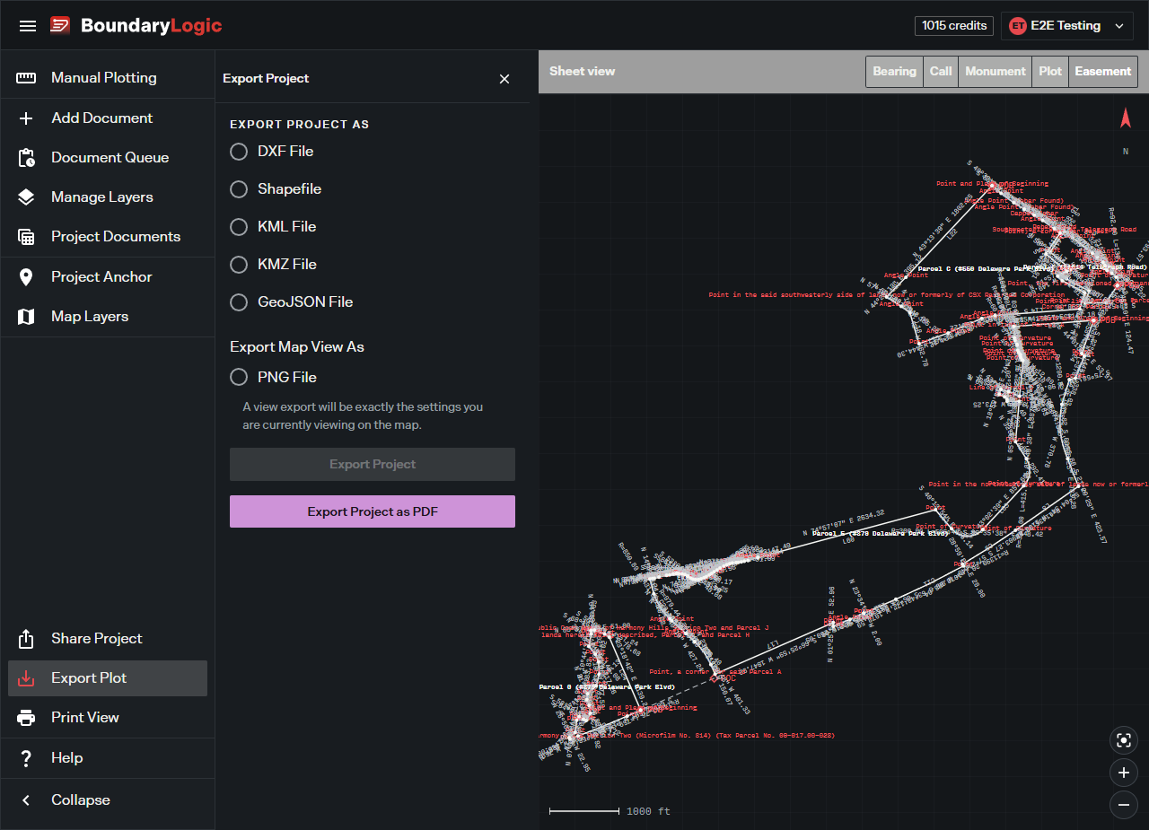
Export Project as PDF opens Print View, where you set the title, boundary labels, disclaimer, call tables, and background. Export a PDF plat covers those settings.
When an export cannot run
Each format names what is missing, for example “DXF file not available for this project.” or “No GeoJSON data available for this project.” A PNG export reports “Map reference not available.” when the map has not finished loading. Plot at least one layer, let the map settle, then export again.
Options
| Format | What it carries | Availability |
|---|---|---|
| A finished plat sheet with title block, call tables, and disclaimer | All plans | |
| DXF File | DXF geometry for CAD | All plans |
| Shapefile | Shapefile geometry for GIS, downloaded as a .zip |
Professional and up |
| KML File | KML for Google Earth and mapping tools | Professional and up |
| KMZ File | The compressed KML equivalent | Professional and up |
| GeoJSON File | GeoJSON for web mapping and data tools | Professional and up |
| PNG File | An image of the map as you are currently viewing it | Professional and up |
Shapefile, KML, KMZ, GeoJSON, and PNG need a paid plan. On Free they stay visible but disabled, with the tooltip “Available on Professional. Upgrade to export Shapefile, KML, KMZ, GeoJSON, and PNG.” PDF and DXF export on every plan.
Turning off the BoundaryLogic Trace logo on a PDF needs Expert. Below Expert the control is disabled and reads “Upgrade to Expert to control the BoundaryLogic Trace logo on your PDF exports.” Title blocks and logos on PDF covers it.
Related
- Export a PDF plat, for the PDF settings and the finished sheet
- Title blocks and logos on PDF, for Expert branding
- Credits and AI plots, for what does use credits