

Availability: All plans
Summary
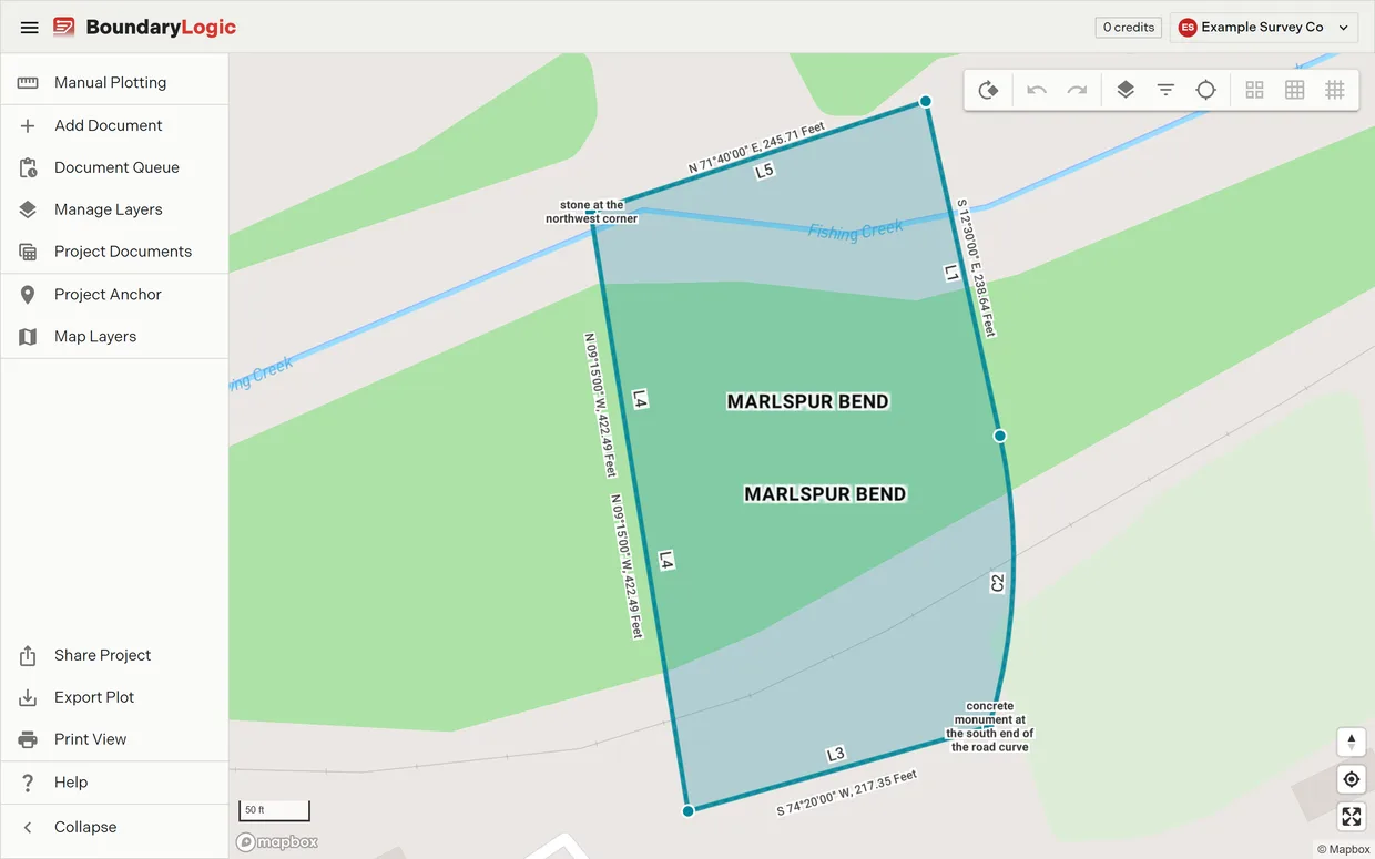
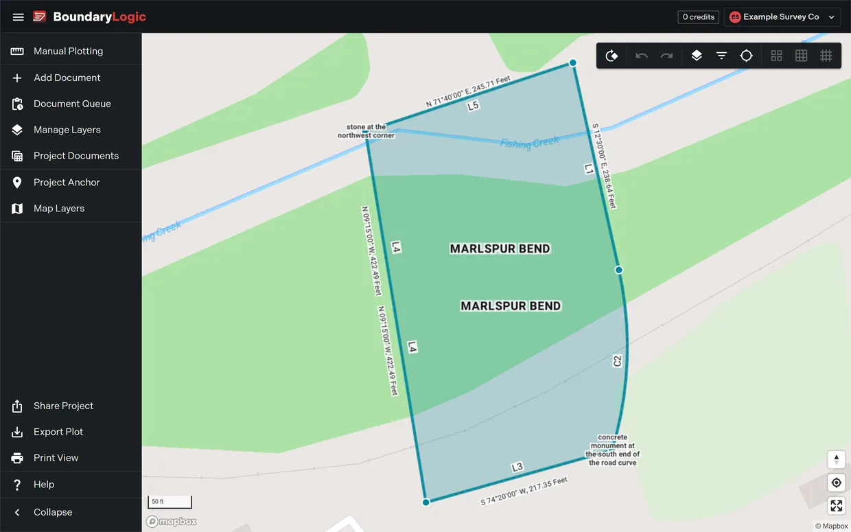
Opening a project puts you in the map workspace. A menu down the left side holds the project’s tools, a nine button toolbar sits at the top right of the map, and the basemap controls sit in the bottom corners. Everything you do to a plot between processing and handoff happens here.
Sheet View is not a separate place. It is one of the map modes inside this workspace, and it shares its label switches with the map.
Usage notes
The project rail
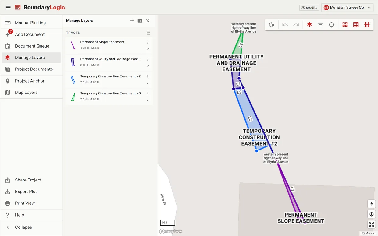
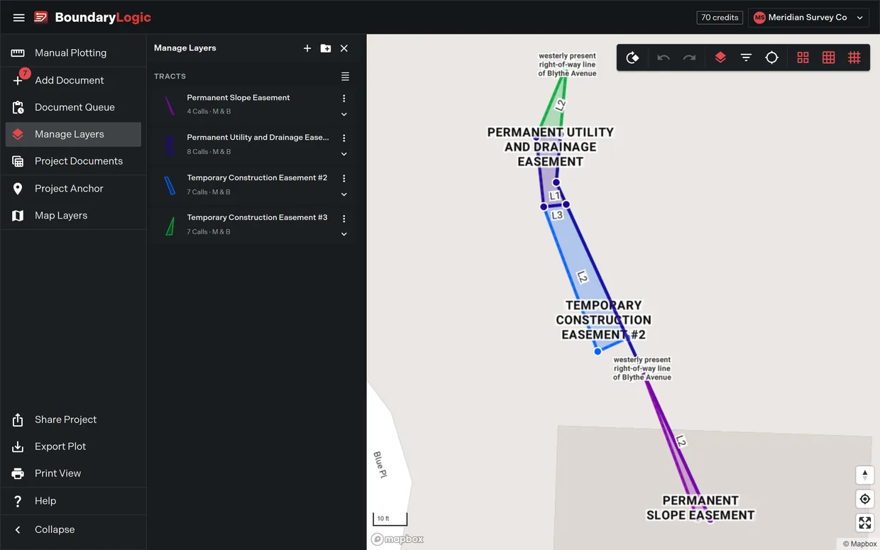
Eleven entries plus a collapse control. Seven of them open a pane beside the map, and clicking the same entry again closes the pane and gives the map its full width back. Share Project opens a dialog instead. Project Documents, Print View and Manual Plotting take over the whole area.
Collapse shrinks the menu to icons only and expands it back to labels.
Three entries need edit access: Manual Plotting, Add Document and Share Project. Without it the first two are disabled with the tooltip View only - editing is disabled, Share Project is absent, and opening the add document or manual plotting URL directly sends you back to the map.
The map toolbar
Nine buttons, left to right: Rotate, Undo, Redo, Manage Layers, Filter Layers, Center on Project, and the three PLSS grid toggles for township, section and quarter sections.
Manage Layers turns blue while its pane is open, and so does Filter Layers while its menu is open. Undo and Redo stay disabled until you move or rotate a plot.
Getting back to the project
Center on Project on the toolbar flies the map to the project anchor. With no anchor set it falls back to the center of the United States. The map right-click menu carries the same move as Fly to Project Anchor.
The basemap controls
The Mapbox controls sit in the map’s bottom corners and work on every plan.
- The compass returns the map to north up, and shows the current bearing while the map is rotated.
- The locate button centers the map on your device’s own position, or reports that permission was denied.
- The full screen button expands the map to fill the screen. The same button or Esc brings it back.
- The scale bar reads in imperial units, and the attribution link opens the Mapbox and OpenStreetMap credits for the basemap.
Drag anywhere the pointer is not over a plot to pan. Scroll or pinch to zoom.
What the map remembers
Trace saves the map’s center, zoom, bearing and pitch one second after it stops moving, and restores them for up to 30 days the next time you open the project on that device. A project with no saved view opens framed on every visible layer instead.
Options
| Menu item | What it opens | Needs edit access |
|---|---|---|
| Manual Plotting | The manual plotting workspace, full area | Yes |
| Add Document | The upload pane, with a badge counting processed documents not yet added | Yes |
| Document Queue | The pane listing documents that are processing, processed or failed | No |
| Manage Layers | The layer pane | No |
| Project Documents | The document and legal description tables, full area | No |
| Project Anchor | The pane that sets the anchor point and anchor type | No |
| Map Layers | The pane that picks the map mode and the PLSS data layers | No |
| Share Project | The public read only link dialog | Yes |
| Export Plot | The export pane for files and images | No |
| Print View | The PDF export workspace, full area | No |
| Help | The in project help and support pane | No |
Related
- Navigate the map, for framing, finding and resetting the view
- Right-click menus on the map, for the three menus and every item in them
- Manage layers, for the layer pane and the layer card
- Map modes and styles, for basemaps and Sheet View
- Trace on small screens, for how the project menu behaves on a phone
- Plot your first deed in Trace, if you are starting from zero