

Availability: All plans
The closure report puts a tract’s area, perimeter, linear misclosure and precision ratio in one place, then shows the arithmetic that produced them. Open it when you need to defend a figure rather than glance at one.
Before you start
- The project holds at least one plotted legal description.
- The description is a closed tract. A centerline easement opens the corridor report instead.
Steps
- In the project menu, click Manage Layers. The pane lists every legal description and image overlay in the project as a card. The map toolbar opens the same pane.
- Click the layer’s card to expand it. The metrics line gives area, perimeter, misclosure and a color coded precision ratio at a glance.
- Click Open Closure Report. The report opens over the map.
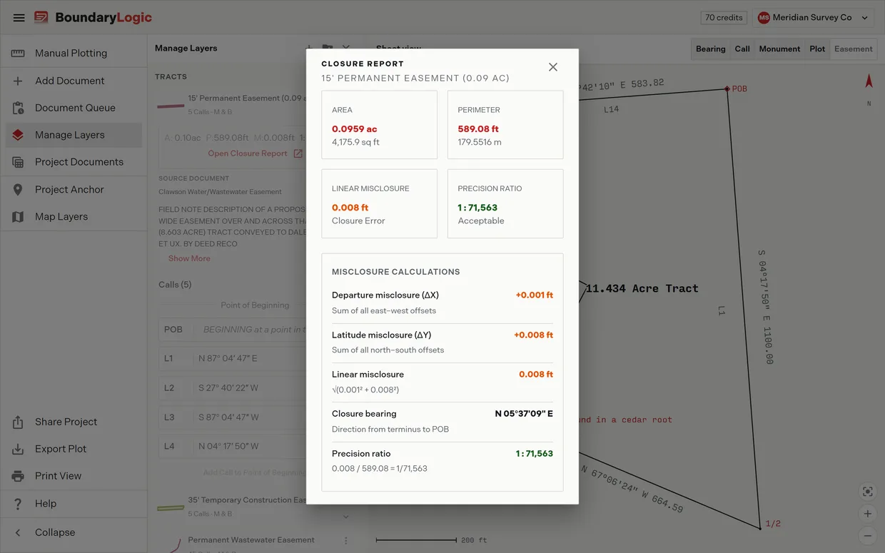
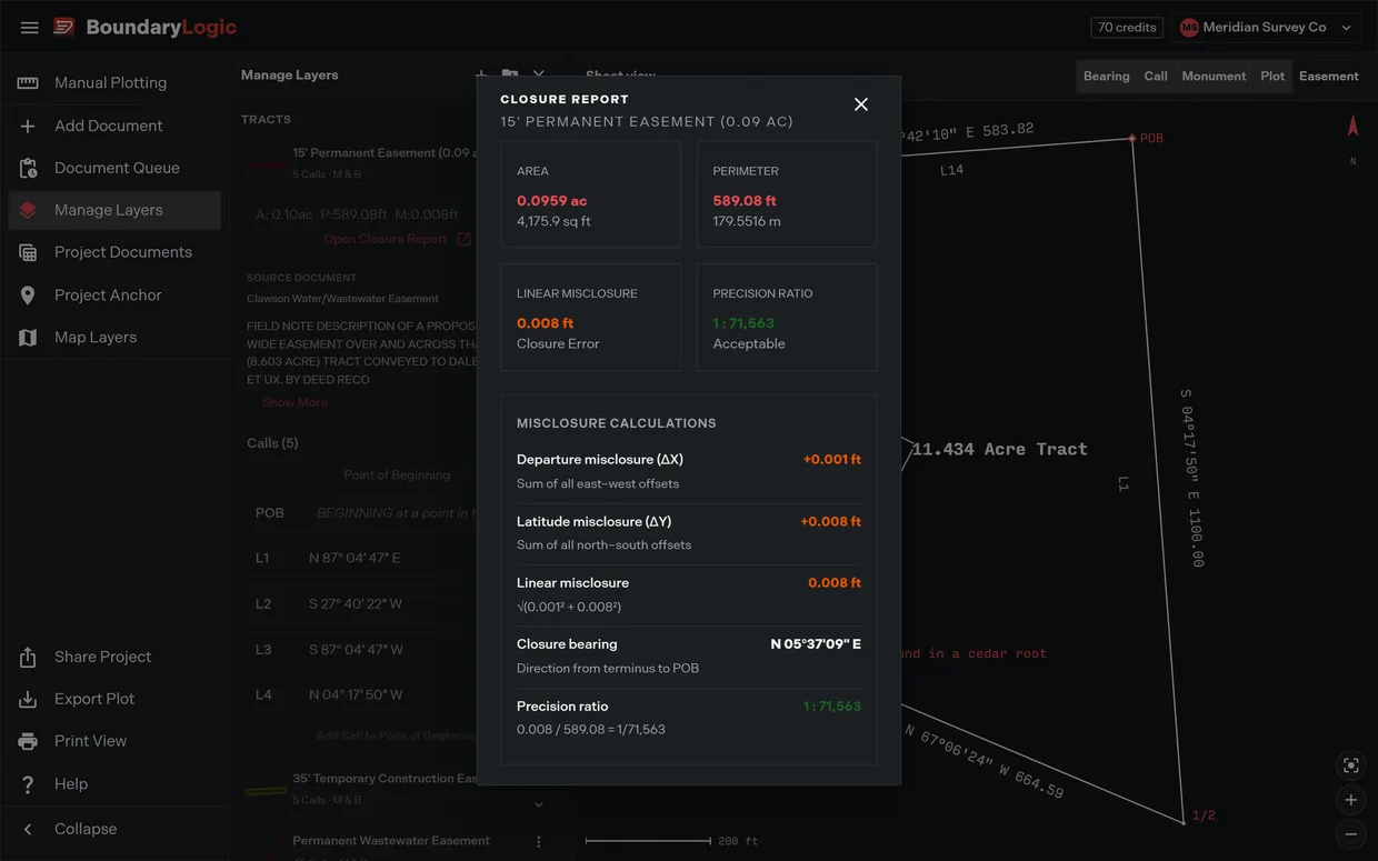
- Read the four cards across the top. Area gives acres over square feet, Perimeter gives feet over meters, Linear Misclosure is labeled Closure Error, and Precision Ratio carries a one word rating.
- Read the Misclosure calculations panel for its five rows: departure misclosure, latitude misclosure, the linear misclosure with its square root, the closure bearing from the terminus back to the point of beginning, and the precision ratio with the division that produced it.
- Click the close control to return to the map.
What the rating means
The Precision Ratio card rates itself Acceptable at 1 in 10,000 or better, Marginal from 1 in 5,000, and Poor below that. It reads N/A when no closure was computed. The rating describes how consistently the description closes on itself, not how well it matches the ground, and the description still gets read against its source. Reading the precision ratio covers the rest.
A worked report
A five call tract, four lines and a curve, reports like this.
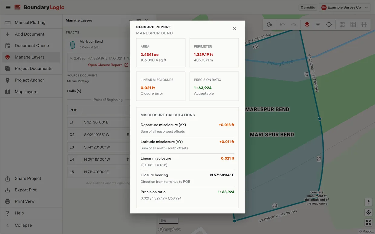
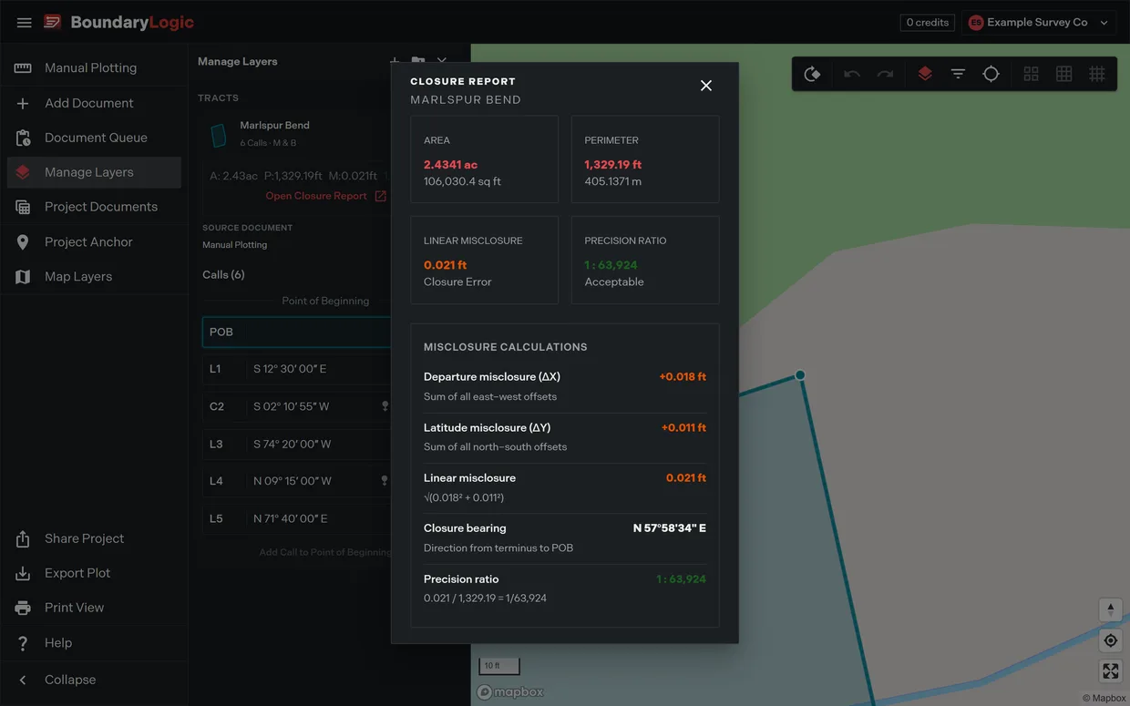
- Area 2.4341 ac over 106,030.4 sq ft, Perimeter 1,329.19 ft over 405.1371 m.
- Closure Error 0.021 ft, Precision Ratio 1 : 63,924, rated Acceptable.
- Departure misclosure +0.018 ft, the sum of all east to west offsets.
- Latitude misclosure +0.011 ft, the sum of all north to south offsets.
- Linear misclosure 0.021 ft, from the square root of 0.018 squared plus 0.011 squared.
- Closure bearing N 57 58 34 E, the direction from the terminus back to the point of beginning.
- Precision ratio 0.021 divided by 1,329.19, giving 1 : 63,924.
Manually plotted tracts
A tract you typed by hand has a closure report on the map workspace, just like one Trace plots from a document, and it reports from the same card. There is no way into the report from inside the manual plotting workspace. To open it:
- In the workspace header, click Back to project. The map workspace opens.
- In the project menu, click Manage Layers.
- Click the tract’s card to expand it.
- Click Open Closure Report.
Inside the editor the closure figures you get are the ones on the tract card, plus Diagnose closure.
The report and the tract card are two calculations of the same traverse, the finished figure and the live one, and they can differ in the last digit. Quote whichever one you are reading.
When there is nothing to report
A tract whose traverse is still open reports “Closure has not been computed for this tract.” and asks for the traverse to be finished. The layer card’s Add Call to Point of Beginning closes an open traverse in one press.
Related
- Verifications, for the same checks on the tract card
- How closure works, for the traverse math behind the report
- Reading the precision ratio, for interpreting the number
- The corridor report, for centerline easements
- Manage Layers, for the pane the report opens from
- Plot your first deed in Trace, if you are starting from zero